The Snapshots in Time Collection
Air Support Chart, Iwo Jima - Annotated Grid Map Showing Landing Beaches and Daily Front Lines, February 1945
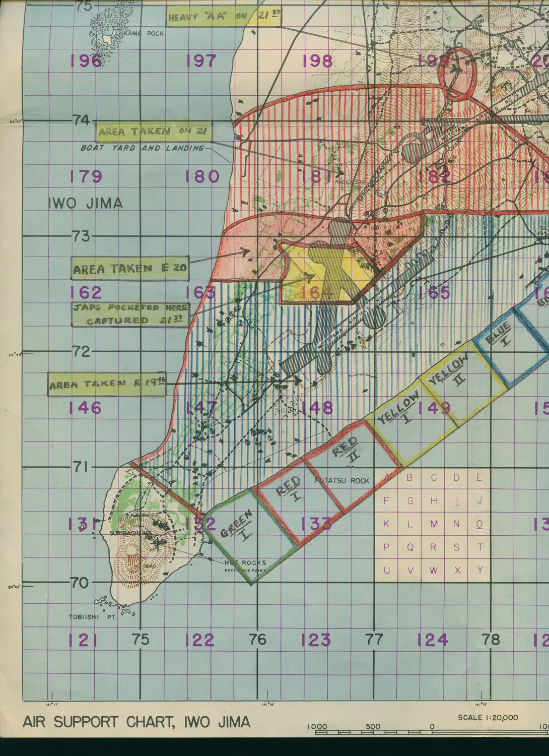
This annotated Air Support Chart of Iwo Jima was used to coordinate naval gunfire, close air support, and track the daily progress of the Marine Corps landing during the battle in February-March 1945. The color-coded beaches—Green, Red, Yellow, and Blue—mark the invasion's landing zones near Mount Suribachi, while hand-written notes track captured ground day by day. Originating from the collection of USS Petrof Bay (CVE-80), an escort carrier that flew close air support missions over Iwo Jima, this chart reflects the critical role of real-time battlefield intelligence in one of the Pacific War's costliest engagements. Project: 218457