The Snapshots in Time Collection
WWII Gridded Topographic Target Map of Iwo Jima with Handwritten Combat Annotations, USS Petrof Bay (CVE-80) Collection
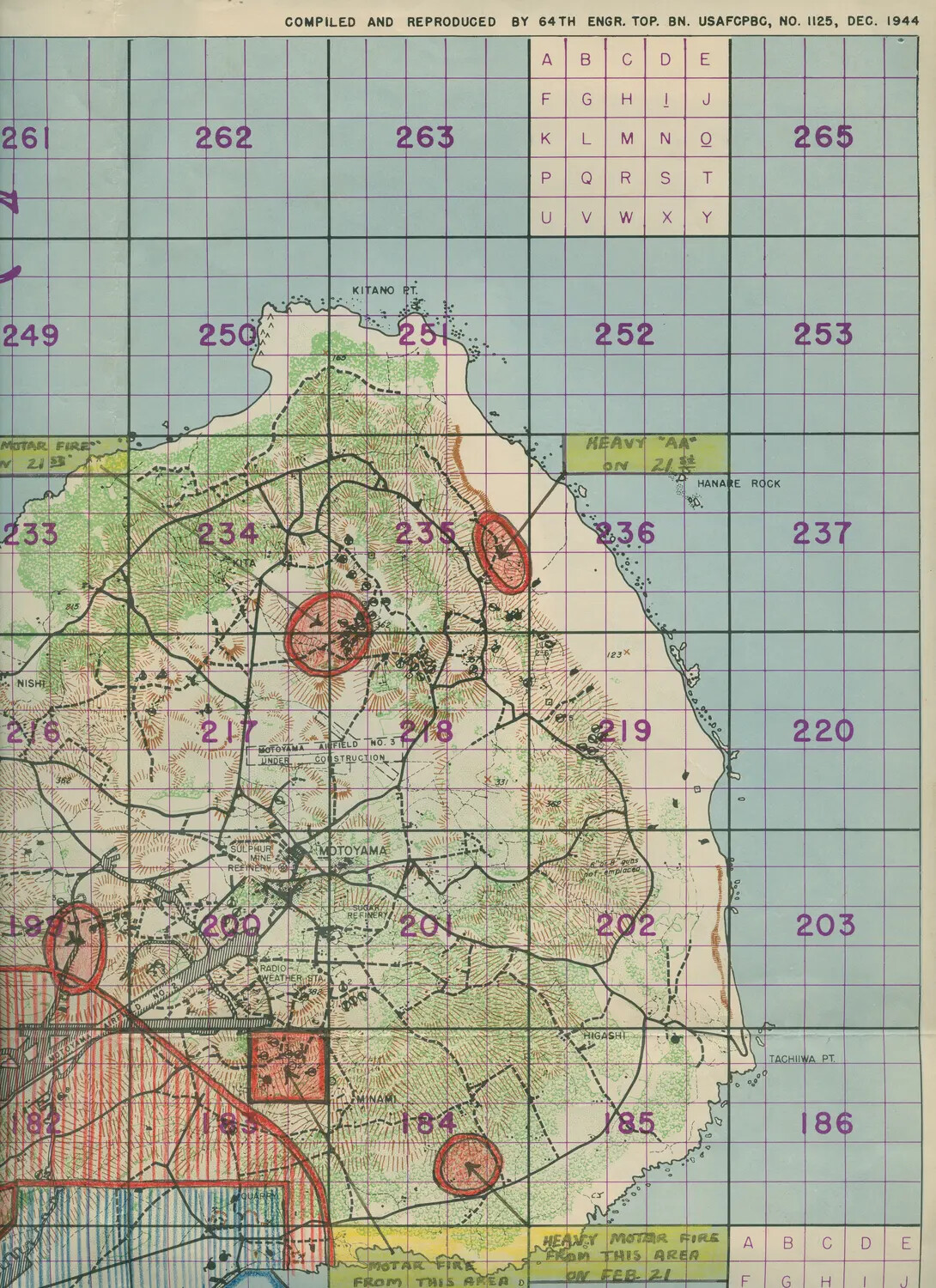
This gridded topographic map of Iwo Jima, produced by the 64th Engineer Topographic Battalion in December 1944, was used to coordinate naval gunfire, air strikes, and ground operations during the February 1945 invasion. Hand-marked annotations noting 'heavy mortar fire' and anti-aircraft activity on February 21 reflect the intense fighting near Motoyama Airfield No. 3, one of the battle's key objectives. Maps like this supported the close air support missions flown from escort carriers such as USS Petrof Bay (CVE-80). Project: 218457