The Snapshots in Time Collection
Confidential Gridded Situation Map of Iwo Jima, USS Petrof Bay (CVE-80) Collection
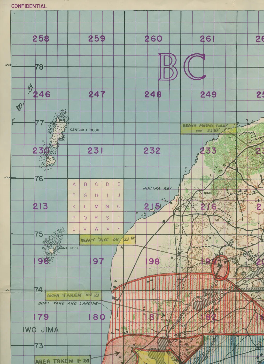
This confidential gridded map of Iwo Jima was used to coordinate naval gunfire, air strikes, and ground operations during the 1945 invasion. Annotations noting heavy mortar and anti-aircraft fire, along with areas taken by advancing Marines, reflect the map's active use in tracking the battle's progress. Maps like this, preserved among the records of escort carriers such as USS Petrof Bay (CVE-80), illustrate the close coordination between sea and land forces during one of the Pacific War's bloodiest campaigns. Project: 218457