The Don Englebreston Collection
Gallery: Joe Parnar Maps, etc
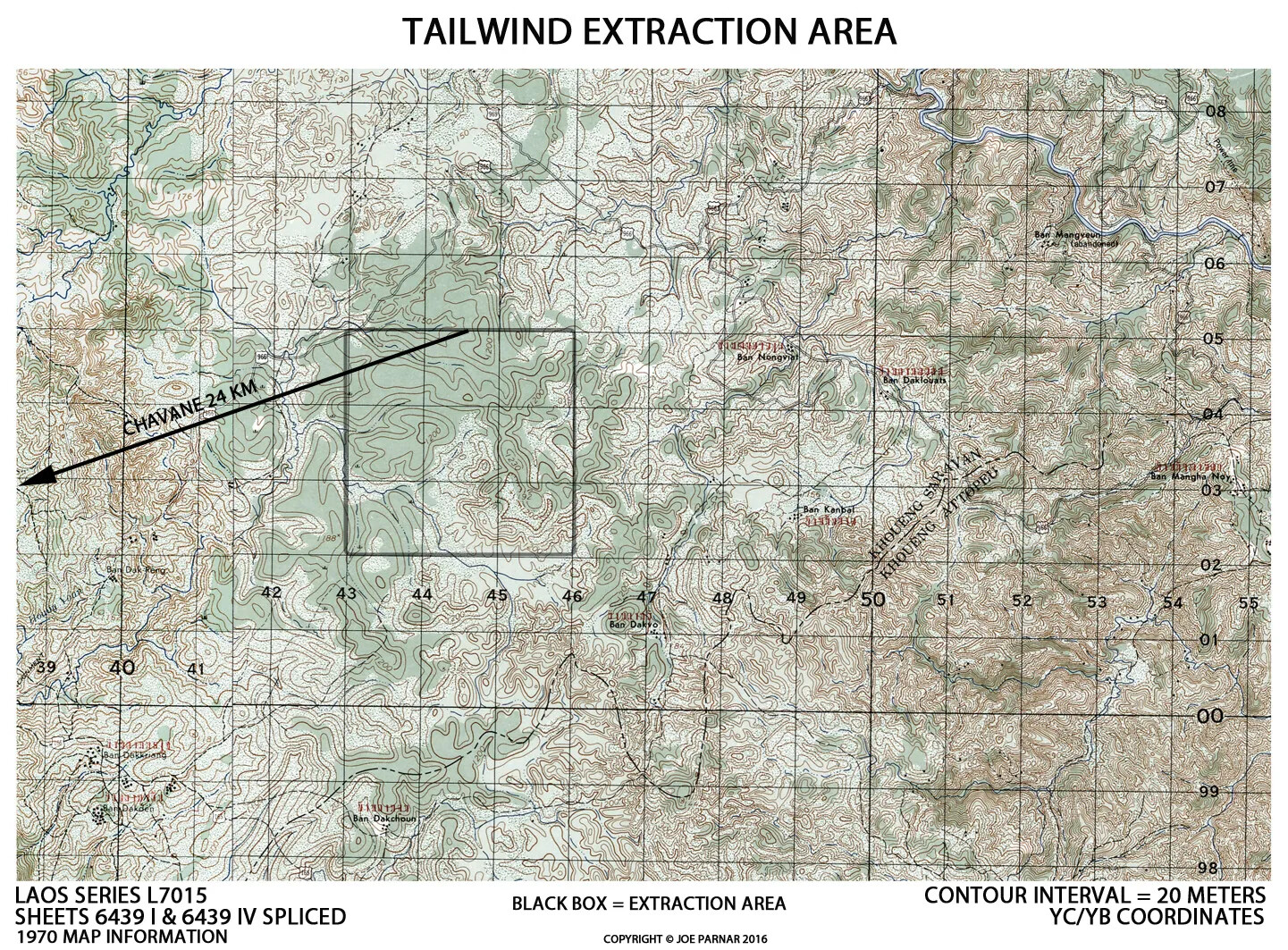
A topographic map of Laos from a 1970 U.S. military survey, annotated by Joe Parnar in 2016 to mark the extraction landing zone used during Operation Tailwind. The hand-drawn notations turn a Series L7015 sheet into a firsthand key to one of the most storied special operations missions of the Vietnam War.
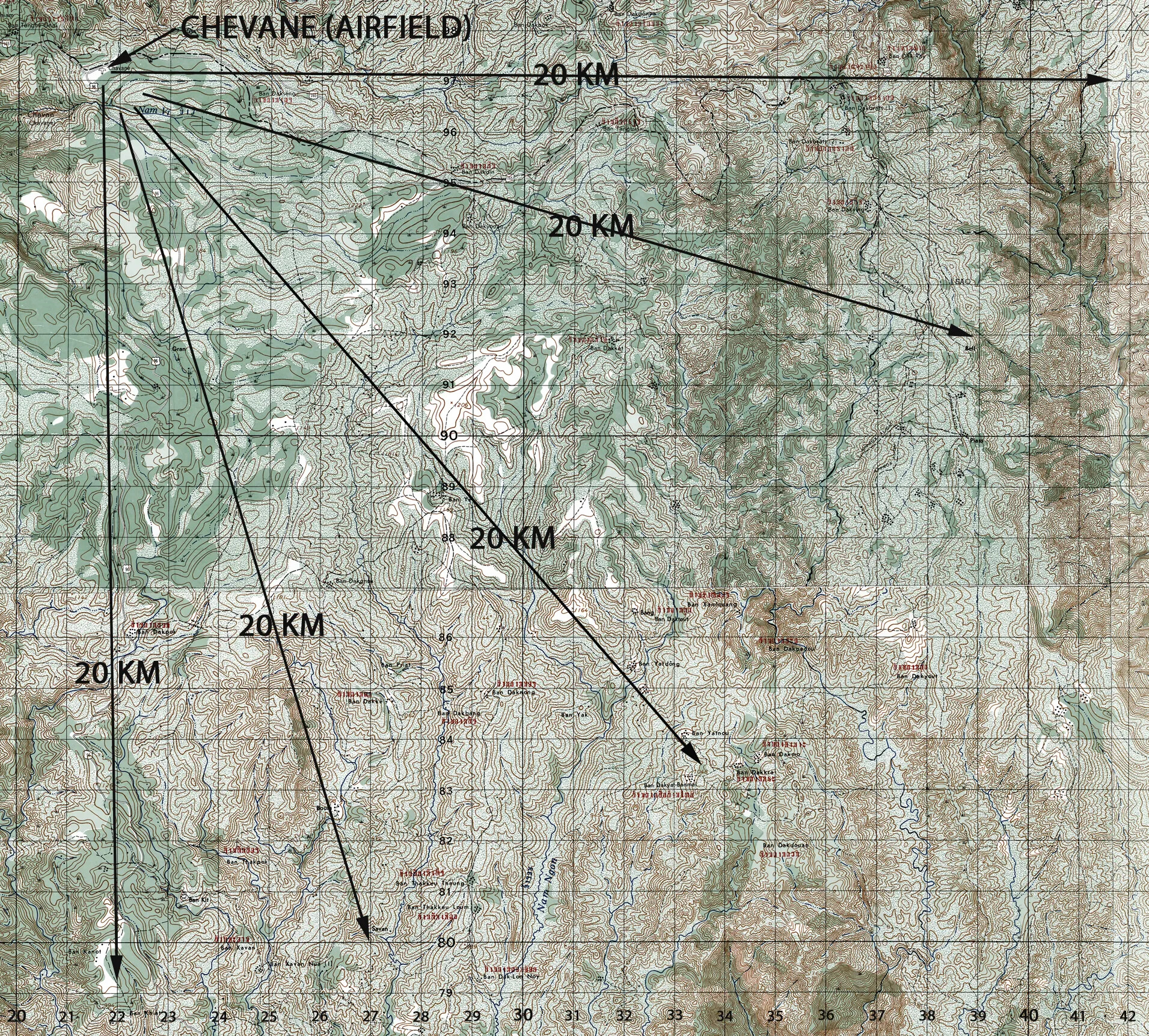
Annotated Topographic Map of Chevane Airfield Area, Laos - Operation Tailwind Planning Reference
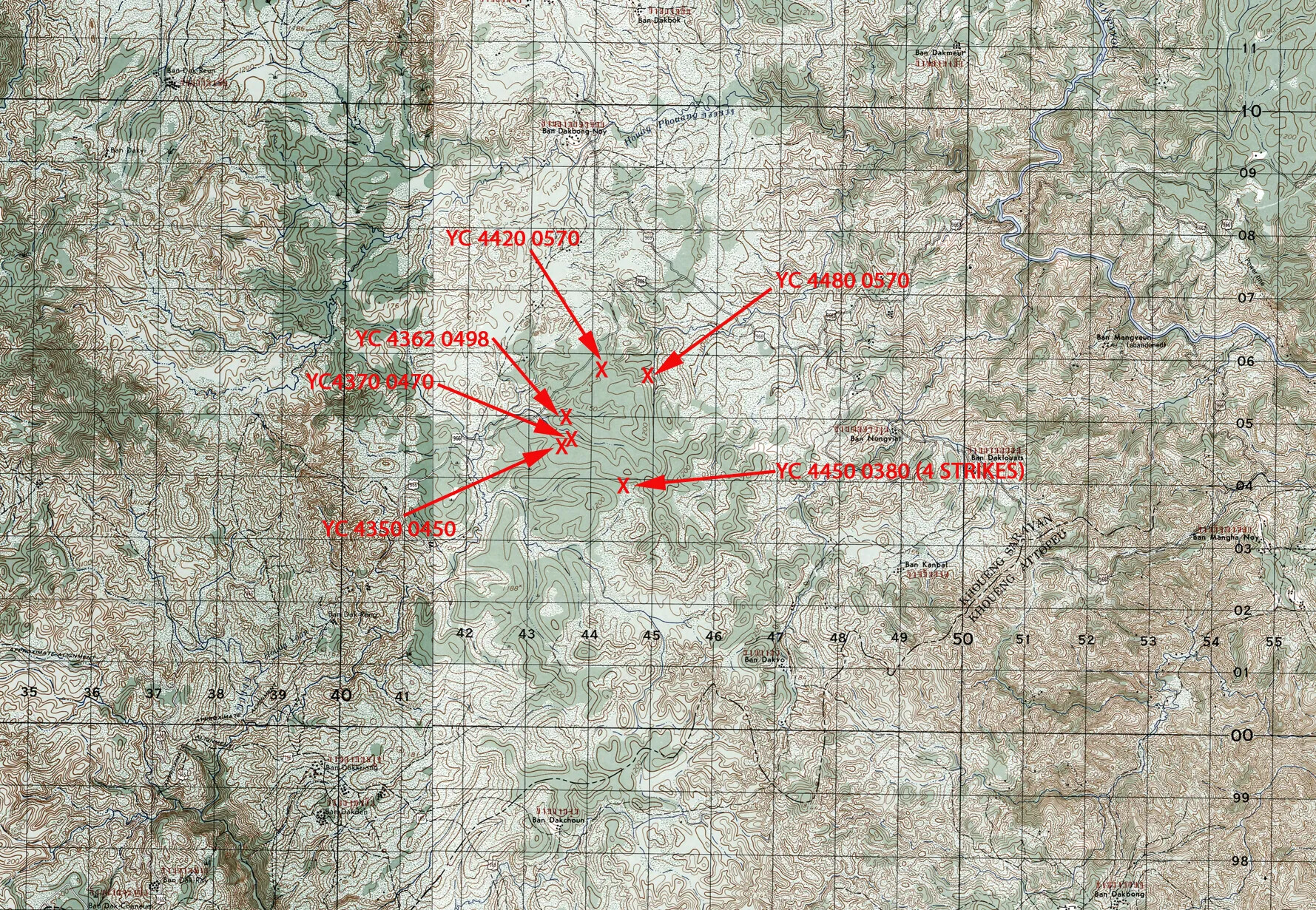
Tailwind Extraction Airstrikes — Annotated 1970 Topographic Map, Laos (Joe Parnar Collection)