The Don Englebreston Collection
Refined Road-Tracing Overlay on Tactical Chart, North/South Vietnam Border
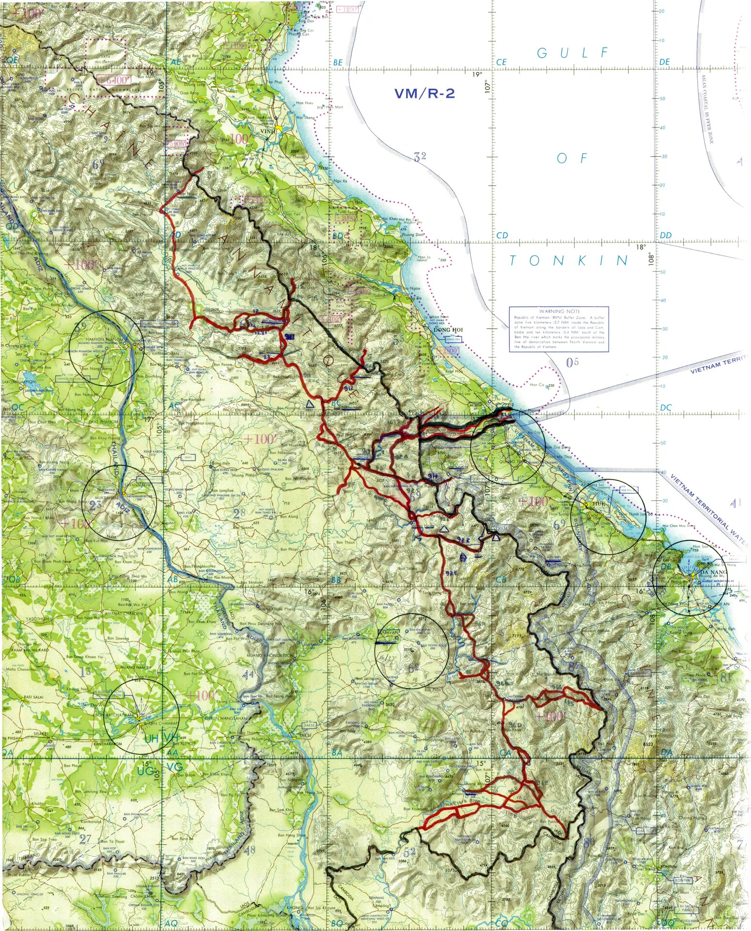
A refined working chart from the Lynn Farnsworth Delta Point collection, showing a partially completed hand-traced road and trail network through Vietnam's Central Highlands. Such maps supported Misty Forward Air Controllers in mapping enemy supply routes along the Ho Chi Minh Trail. Project: 218861