The Snapshots in Time Collection
Aerial Camera Minimum Altitude Reference Chart, USS Petrof Bay (CVE-80), WWII
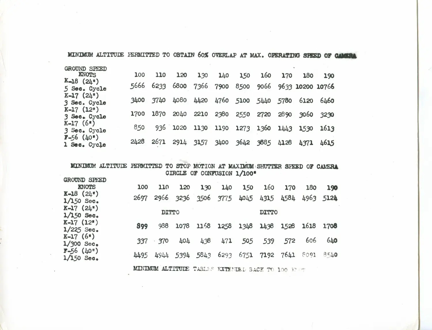
A wartime technical reference chart from the USS Petrof Bay (CVE-80) collection, used to calculate minimum safe flight altitudes for aerial reconnaissance cameras such as the K-17, K-18, and F-56. Charts like this guided photographic reconnaissance missions during World War II, ensuring clear, properly overlapping images for mapping and intelligence purposes. Project: 218459