The Snapshots in Time Collection
Annotated Aerial Reconnaissance Photograph, Mandalay Area, Burma, WWII China-Burma-India Theater
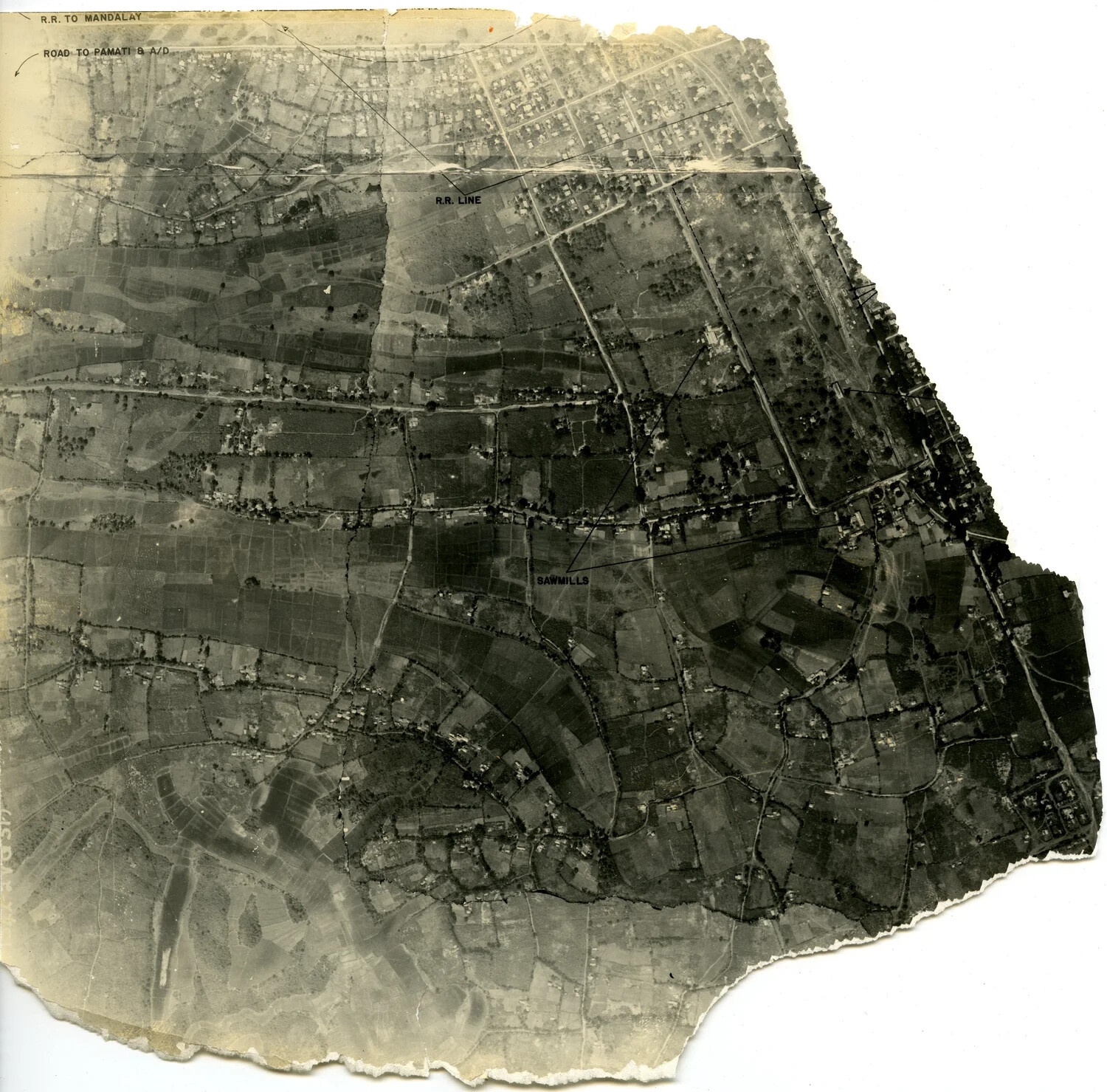
This annotated aerial reconnaissance photograph of terrain near Mandalay, Burma, was used by Allied intelligence to identify key infrastructure, including a railroad line, road network, an airdrome, and sawmills. Photographs like this, part of the broader effort of aerial photo-intelligence gathering, played a critical role in planning operations during the China-Burma-India theater of World War II. Project: 218097